Portfolio
Selected GIS, remote sensing, and geospatial analysis projects — including hydrology workflows, DEM conditioning, land cover classification/change detection, ecosystem services modeling, and Python/ArcPy automation.

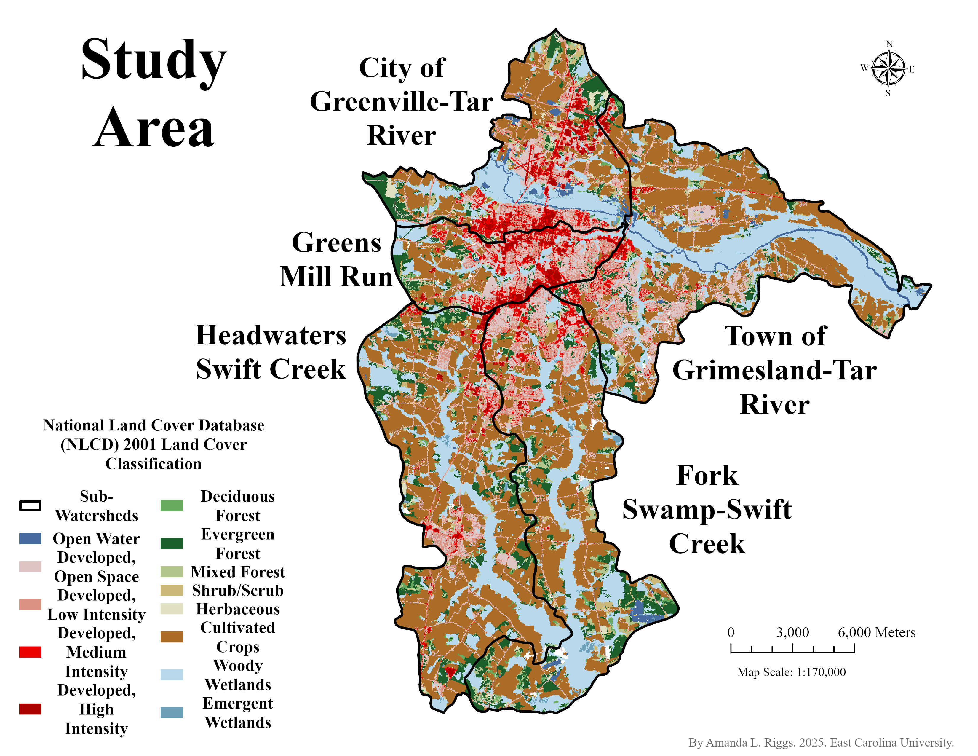
Case Study 01: Frog Level / Davenport Farm Corridor
Corridor-level drainage and terrain screening designed to flag likely low spots, runoff pathways, and potential road–drainage conflict areas. Built for clear communication and fast review.

Case Study 02: North Edwards Rd — Roadway Drainage Conflict
Site-focused screening highlighting an observed roadway ponding location and a likely cross-drain deficiency. Contributing area signals support why flow appears to route along the road shoulder instead of reconnecting to the adjacent natural flow path — providing a clear target for field verification.
Featured Projects
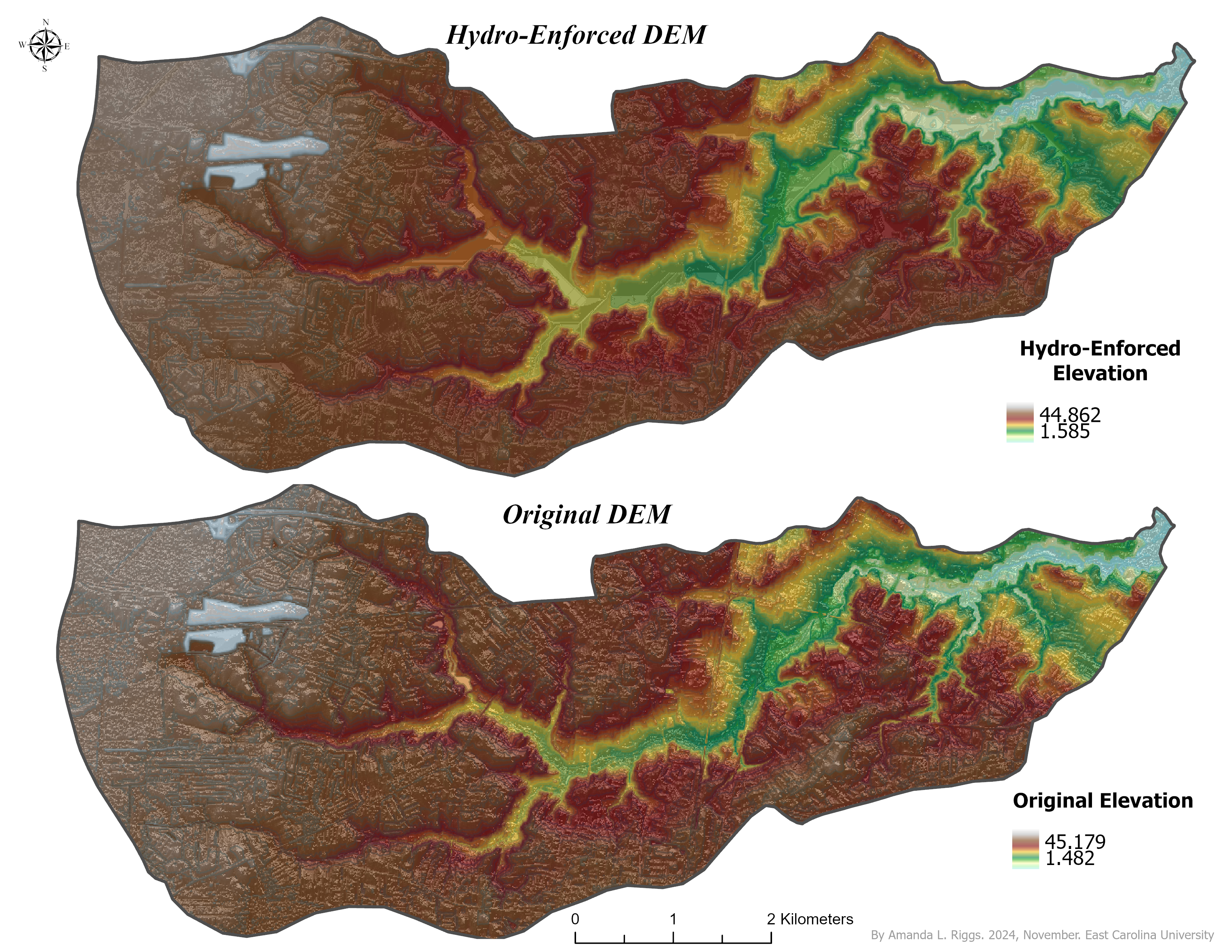
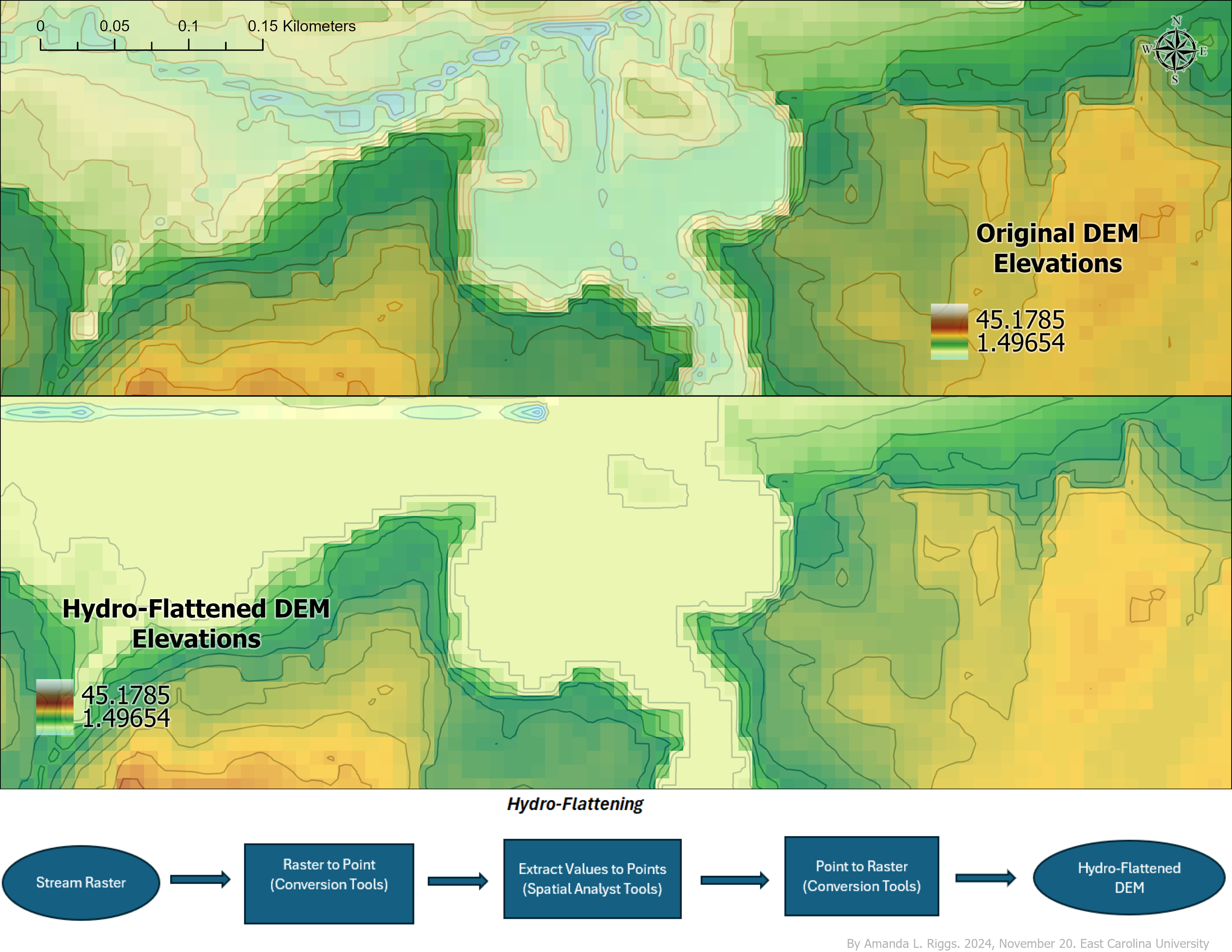
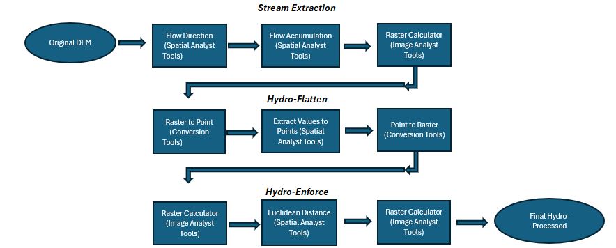
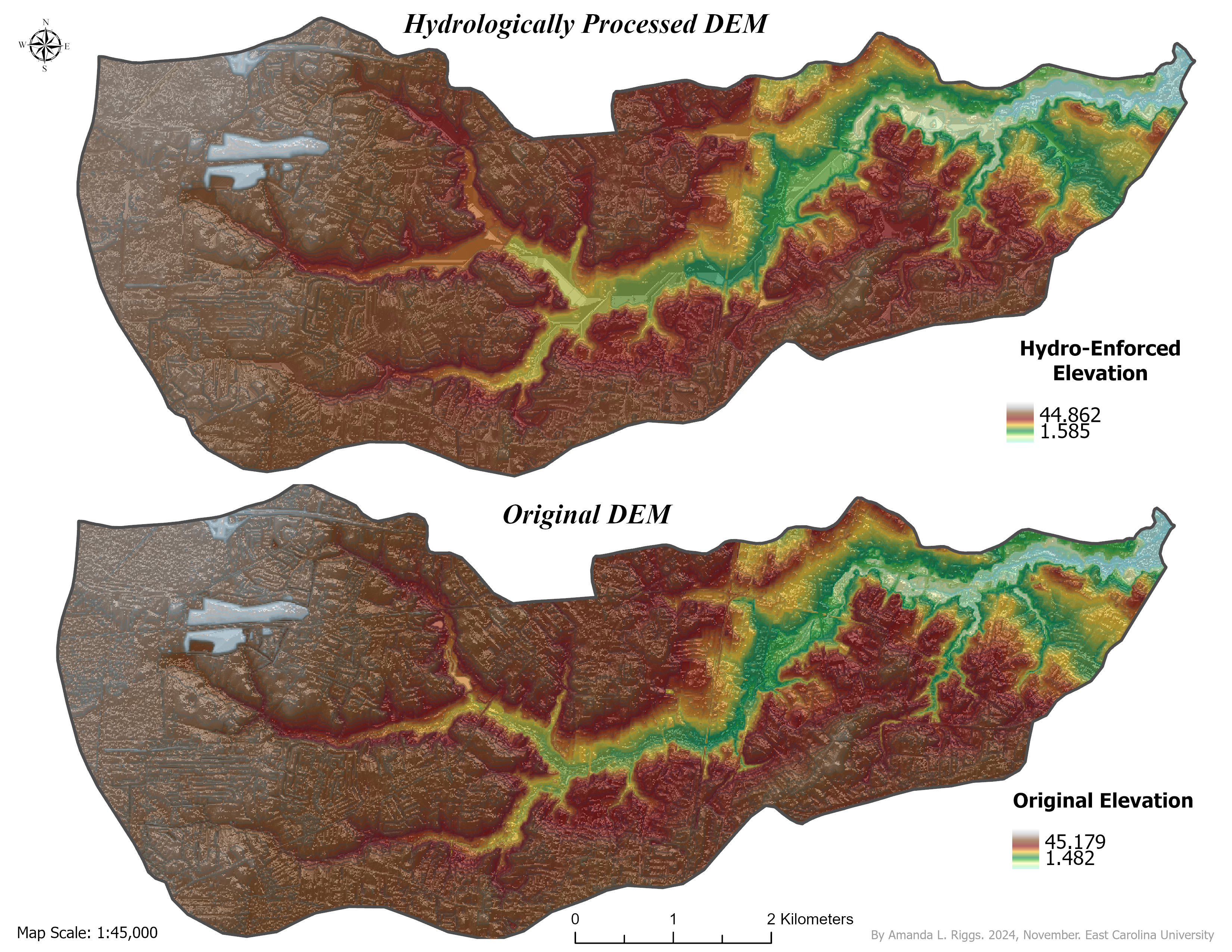
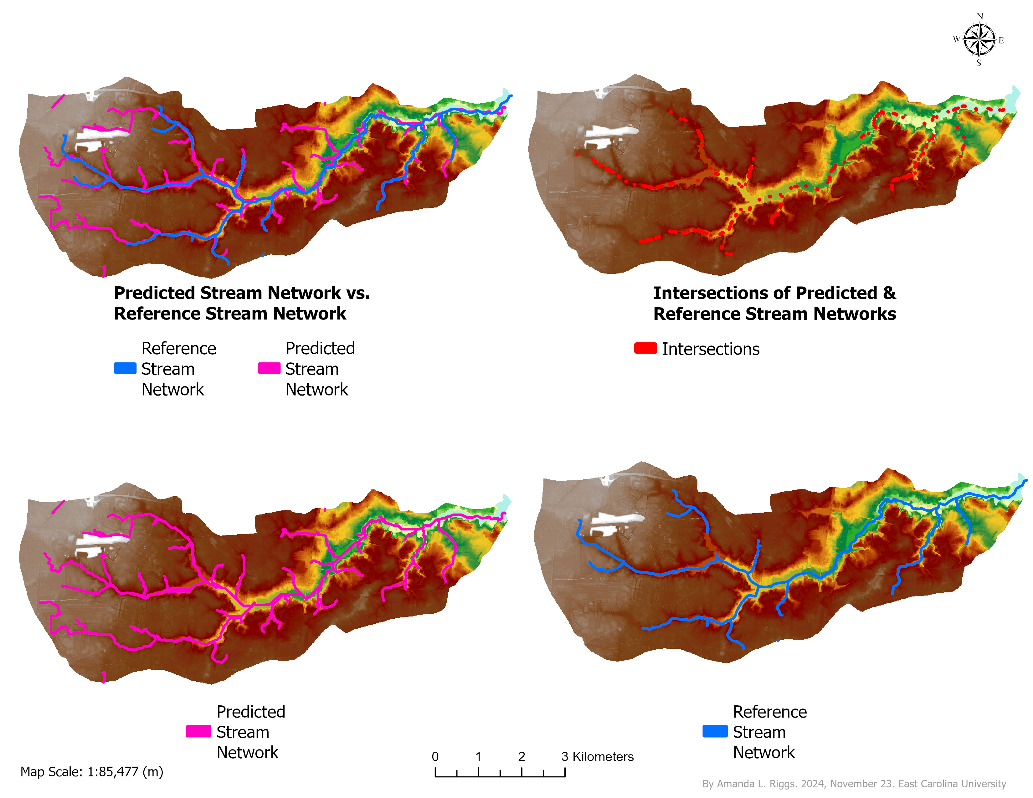
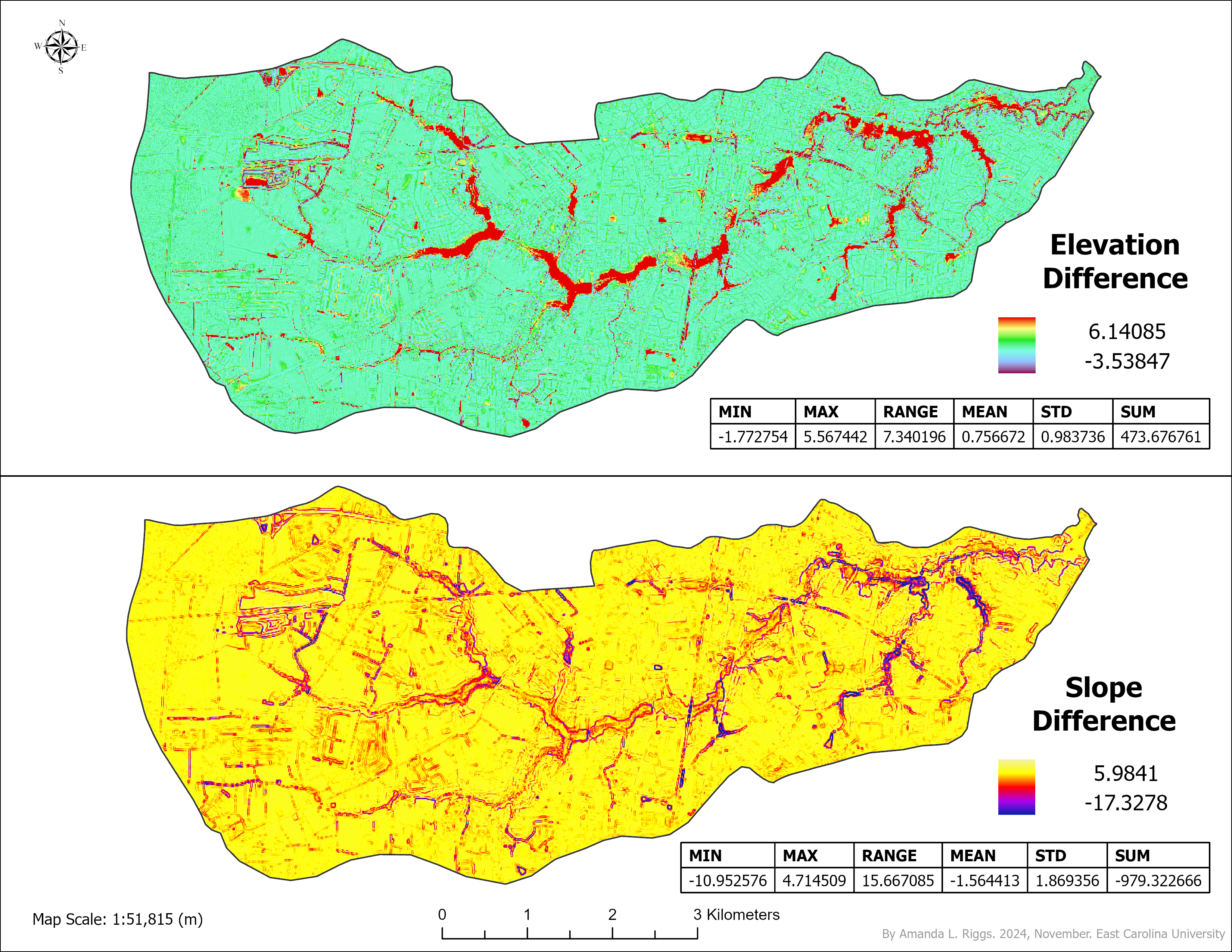
Hydrologically Conditioned DEM & Stream Network
Built a hydrologically conditioned DEM and extracted a detailed stream network from LiDAR-derived elevation data. Workflow included DEM preprocessing, stream burning, flow direction/accumulation, threshold testing, and validation using overlap ratio and IoU metrics.
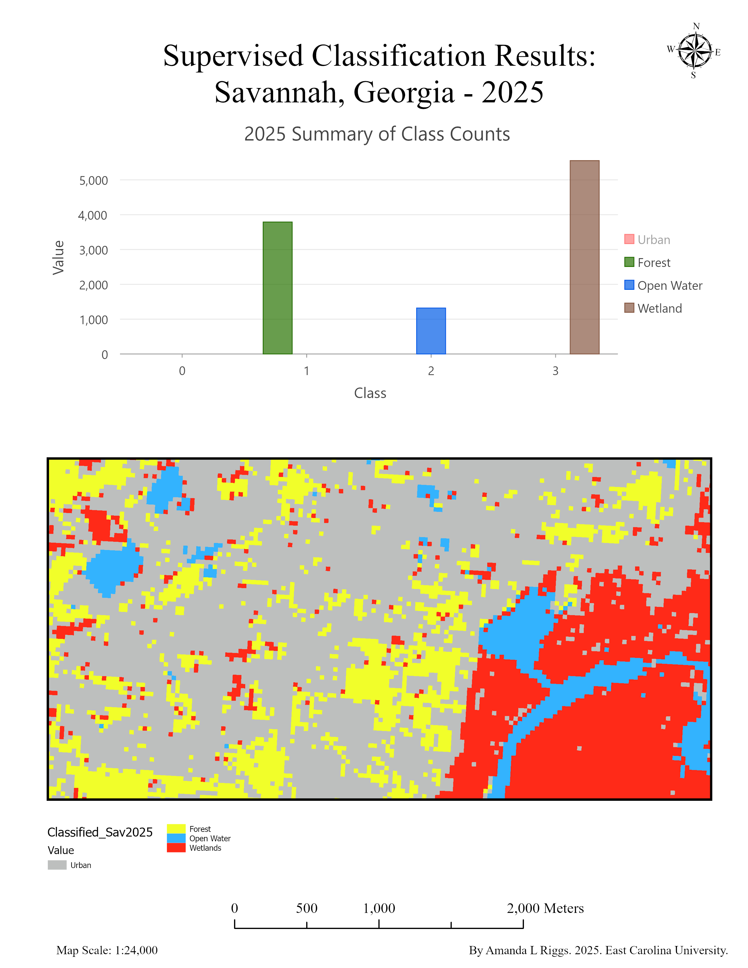
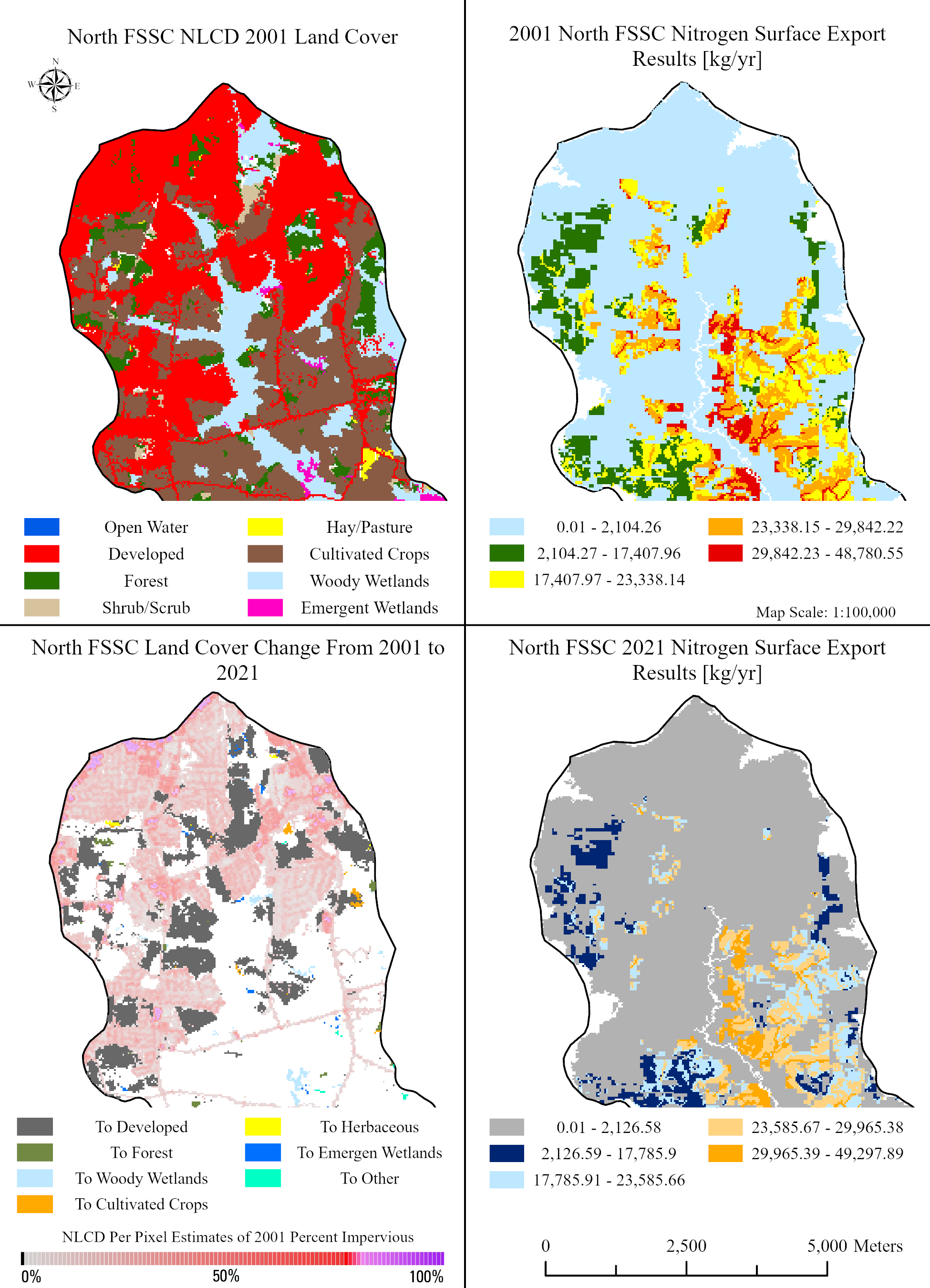
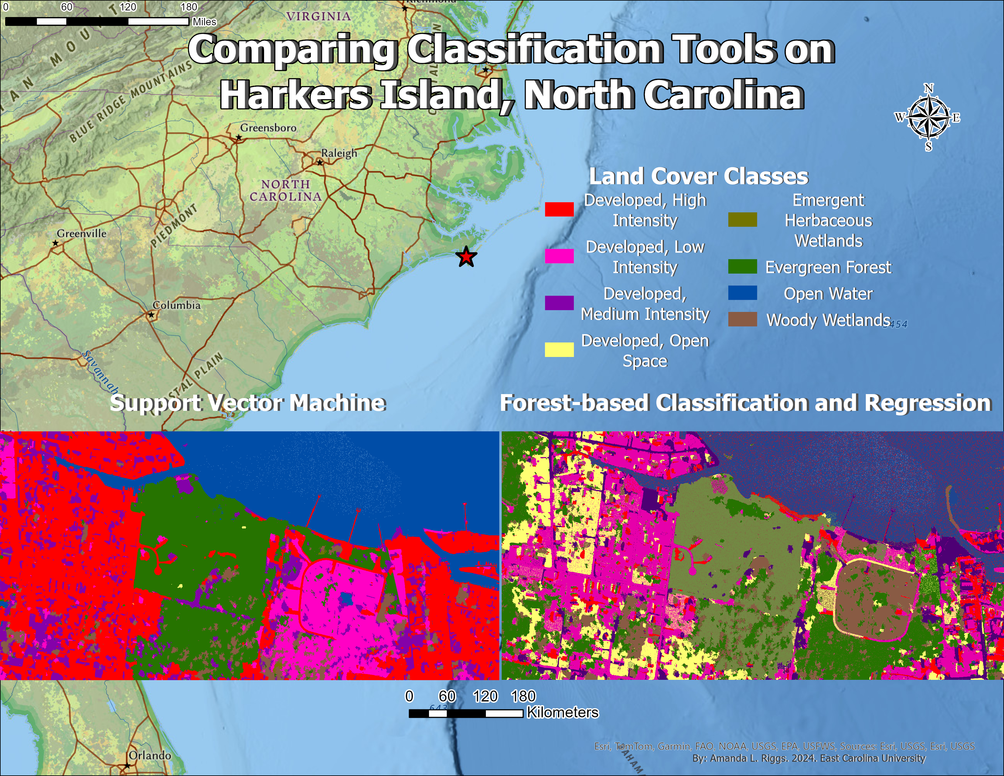
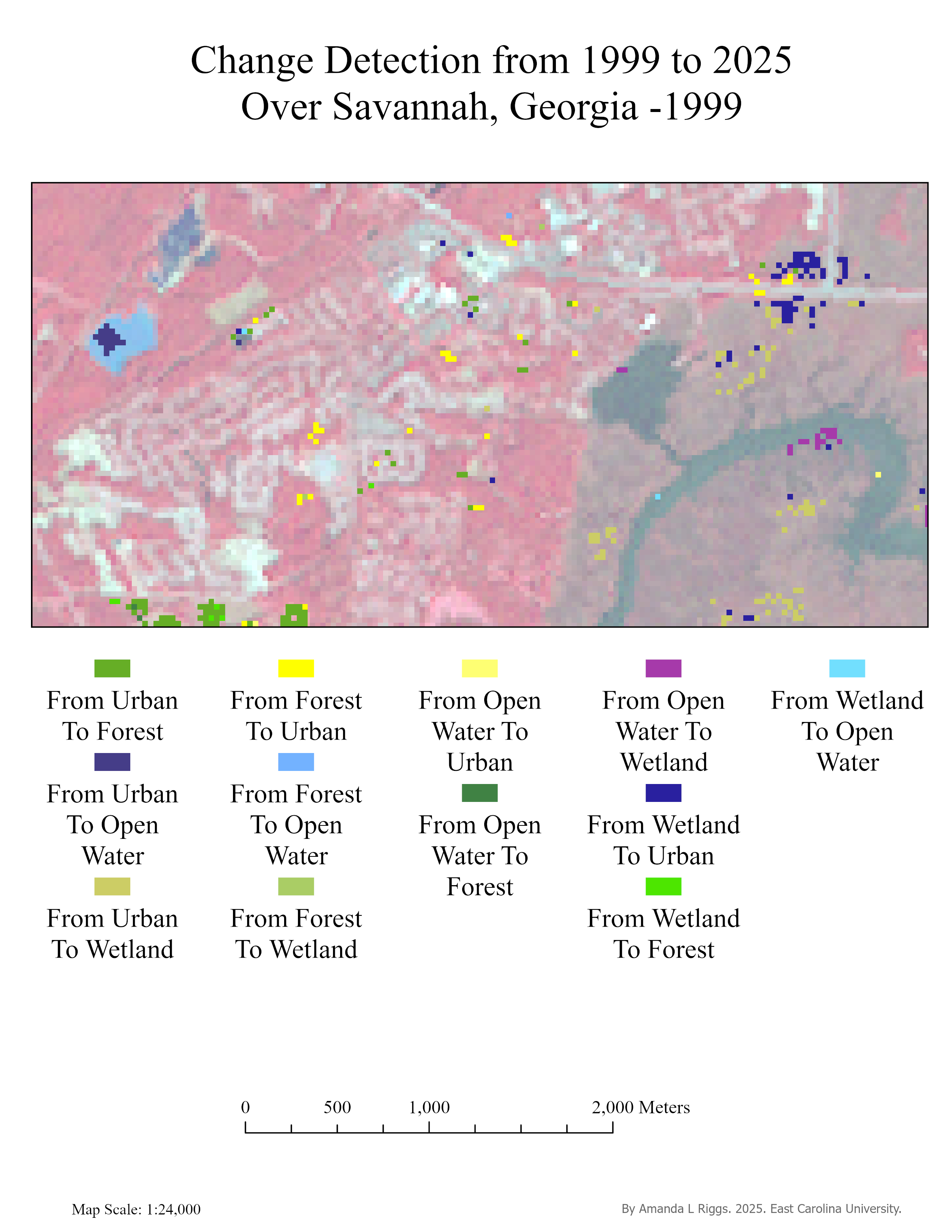
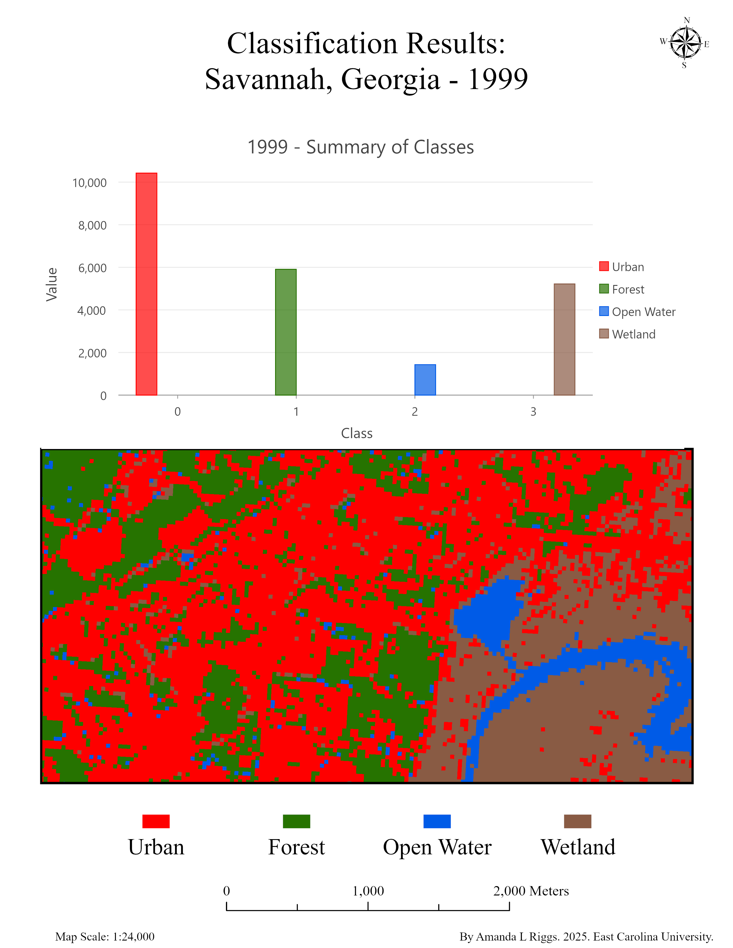
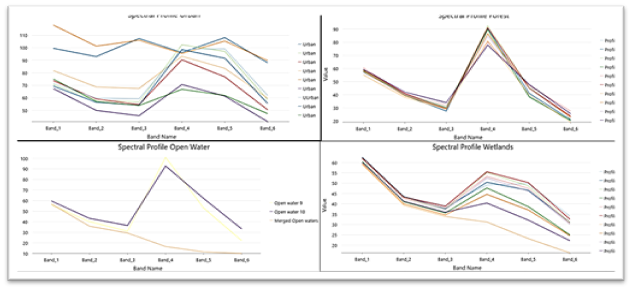
Urban Land Cover Classification & Change (Savannah)
Supervised classification of Landsat imagery to map urban, forest, wetland, agriculture, and water classes, followed by accuracy assessment and change detection between 1999 and 2025.
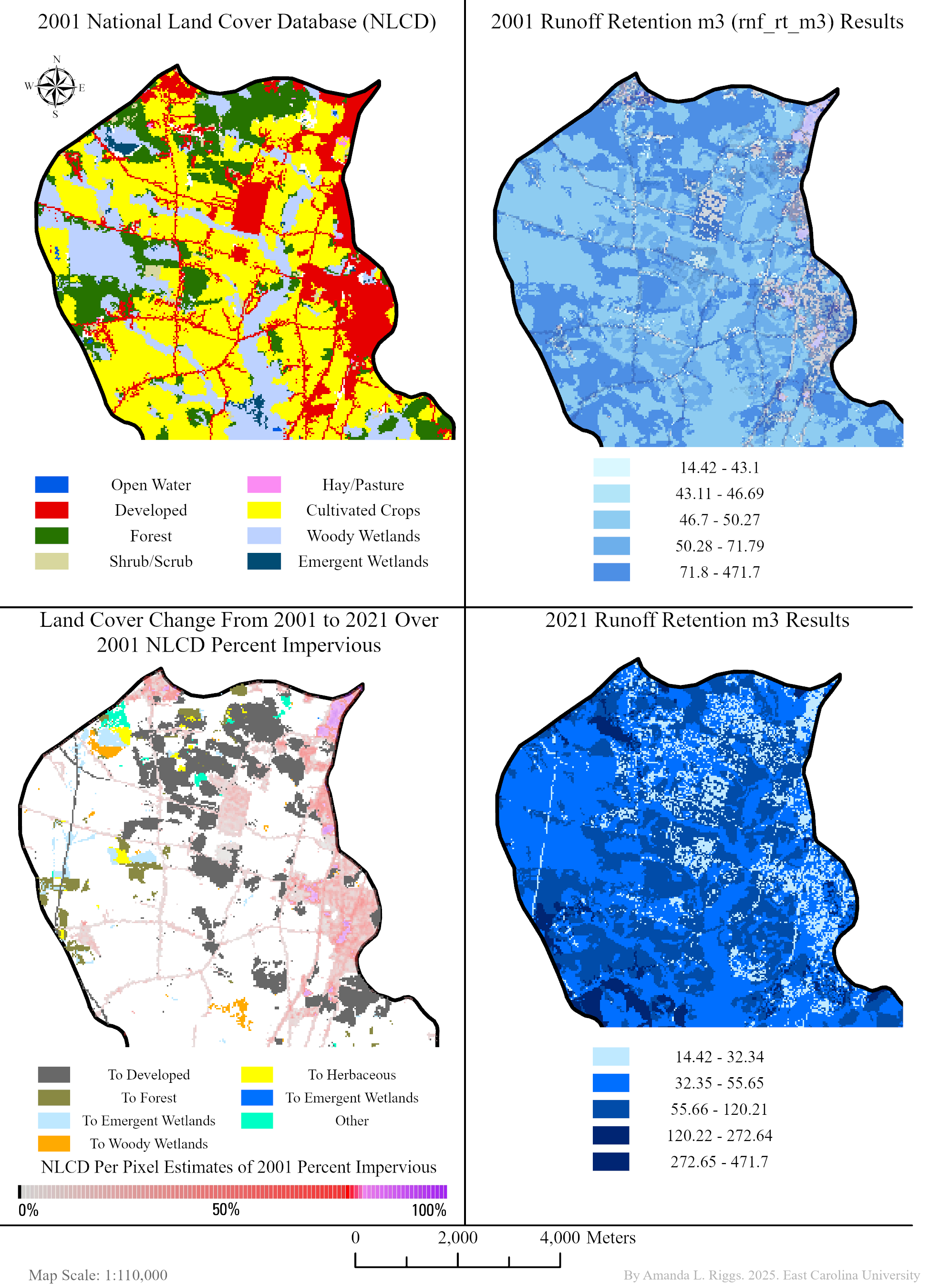
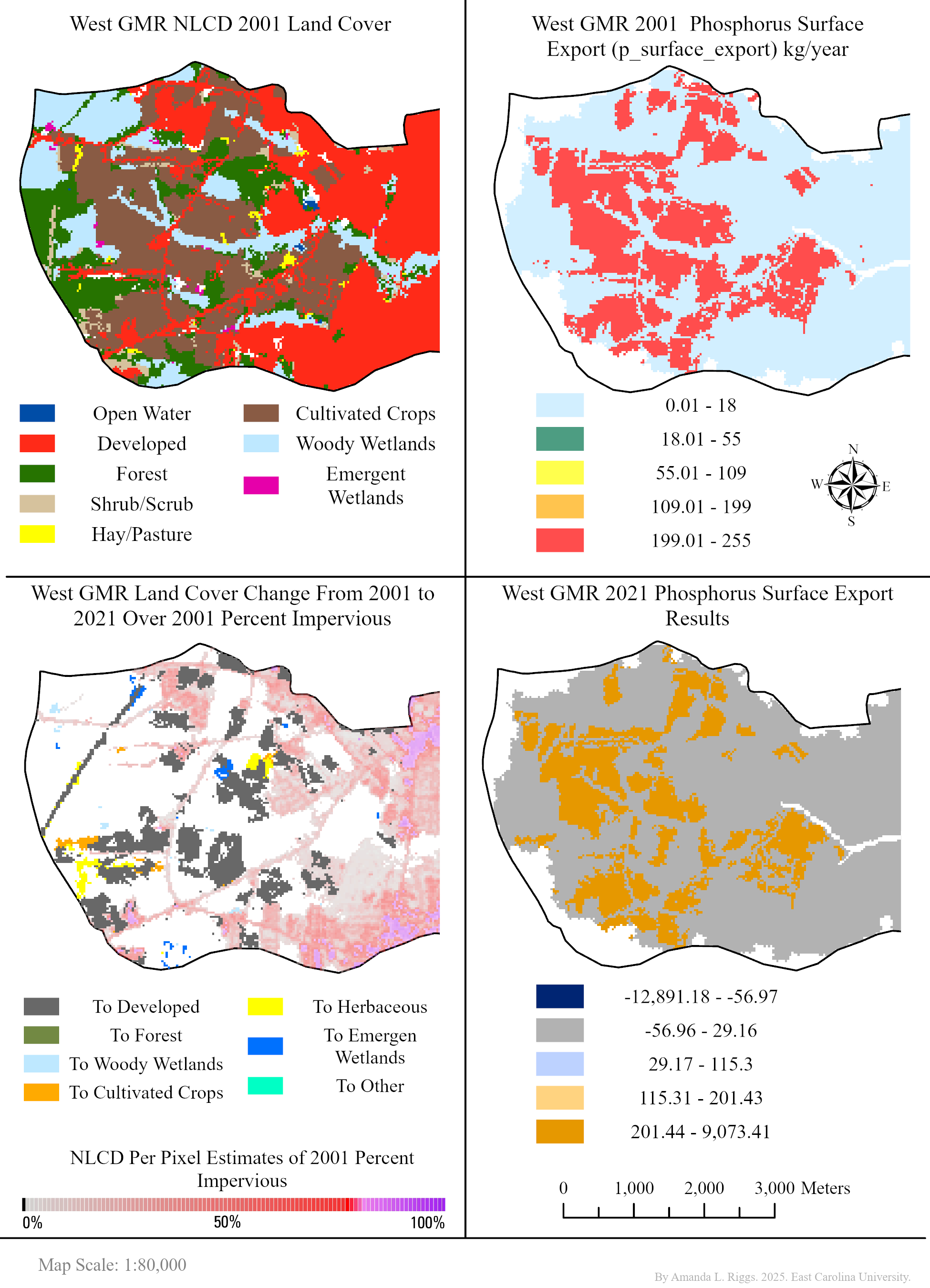
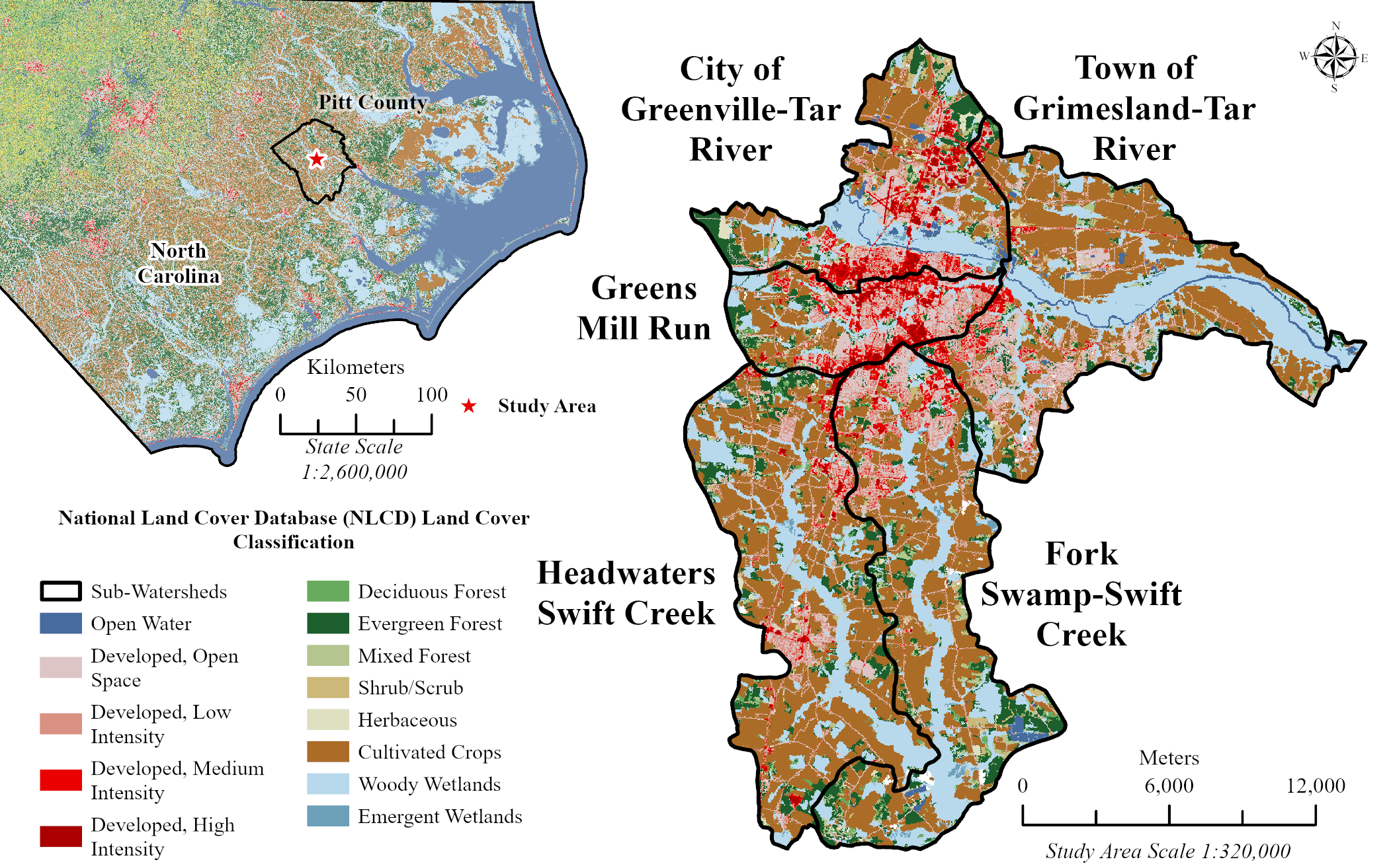
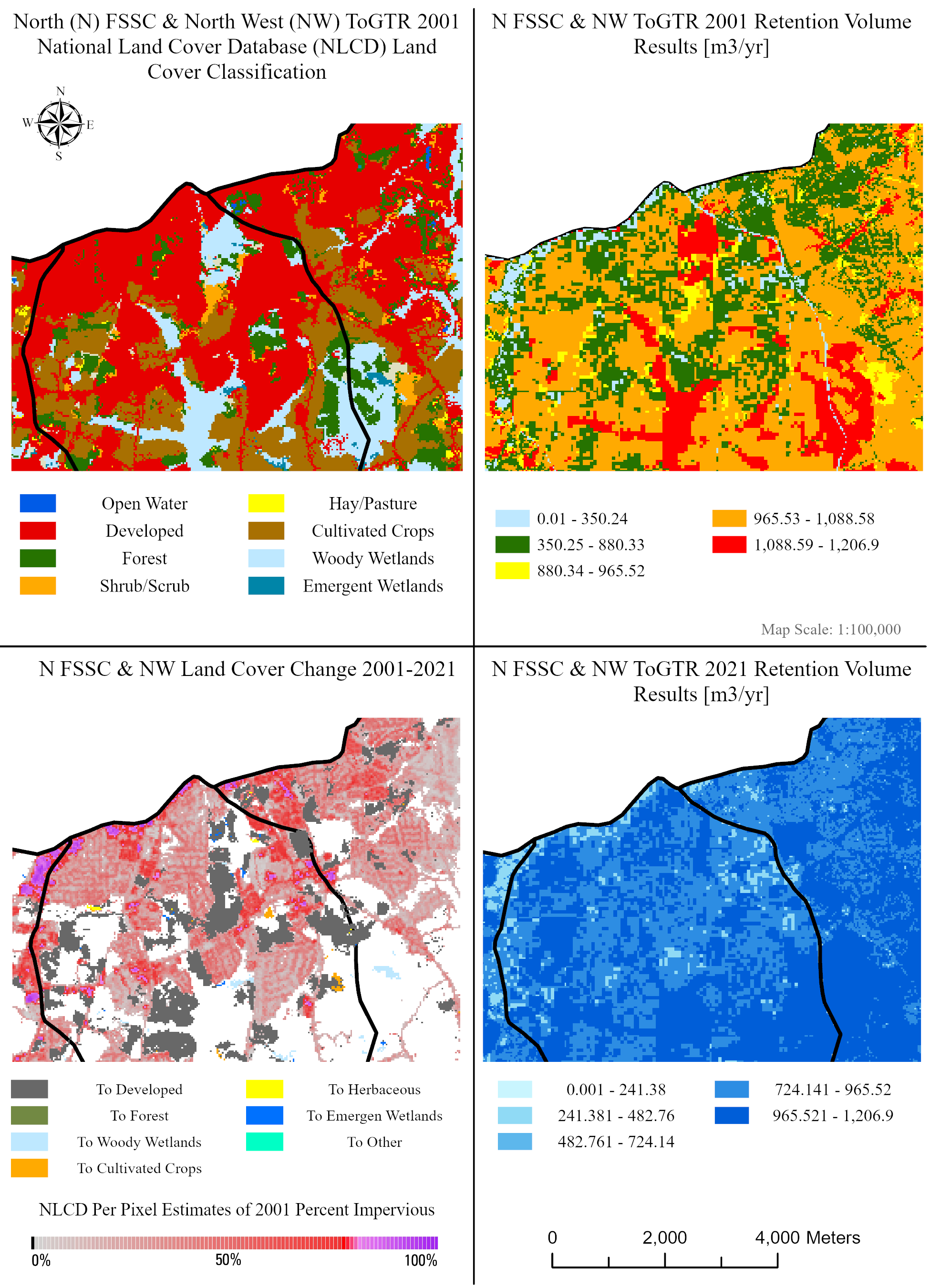
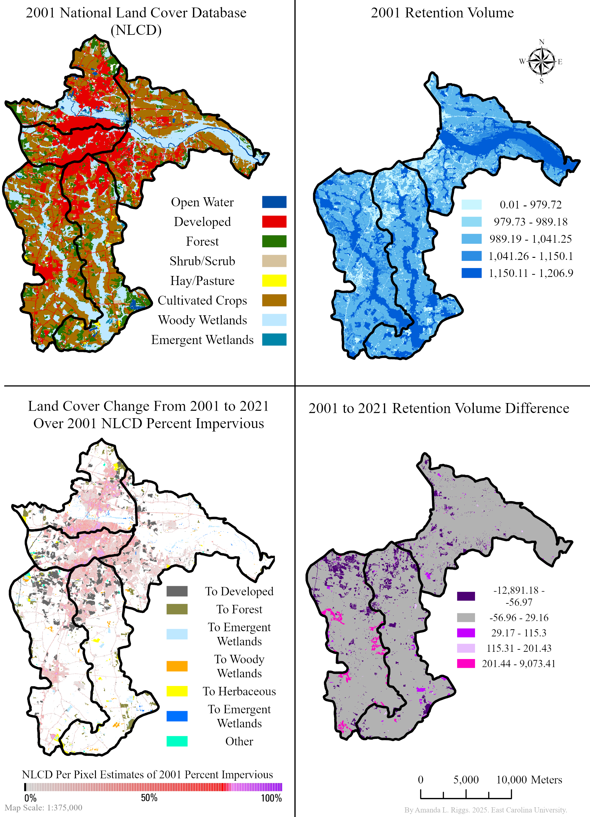
Urban Ecosystem Services Assessment (InVEST)
Modeled nutrient delivery, stormwater retention, and urban flood mitigation using the InVEST suite. Integrated land use, soils, topography, and infrastructure to evaluate tradeoffs between development and ecosystem services.
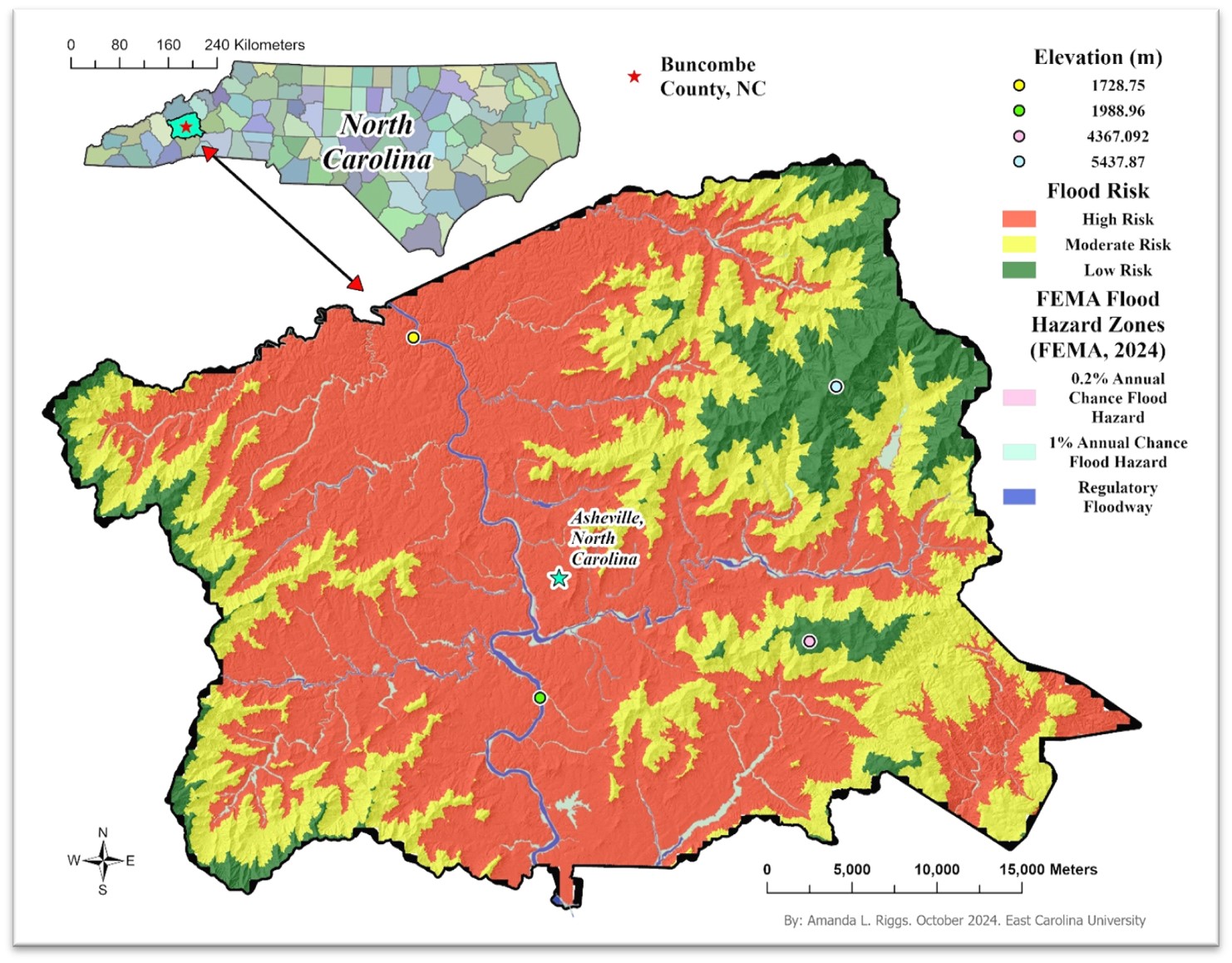
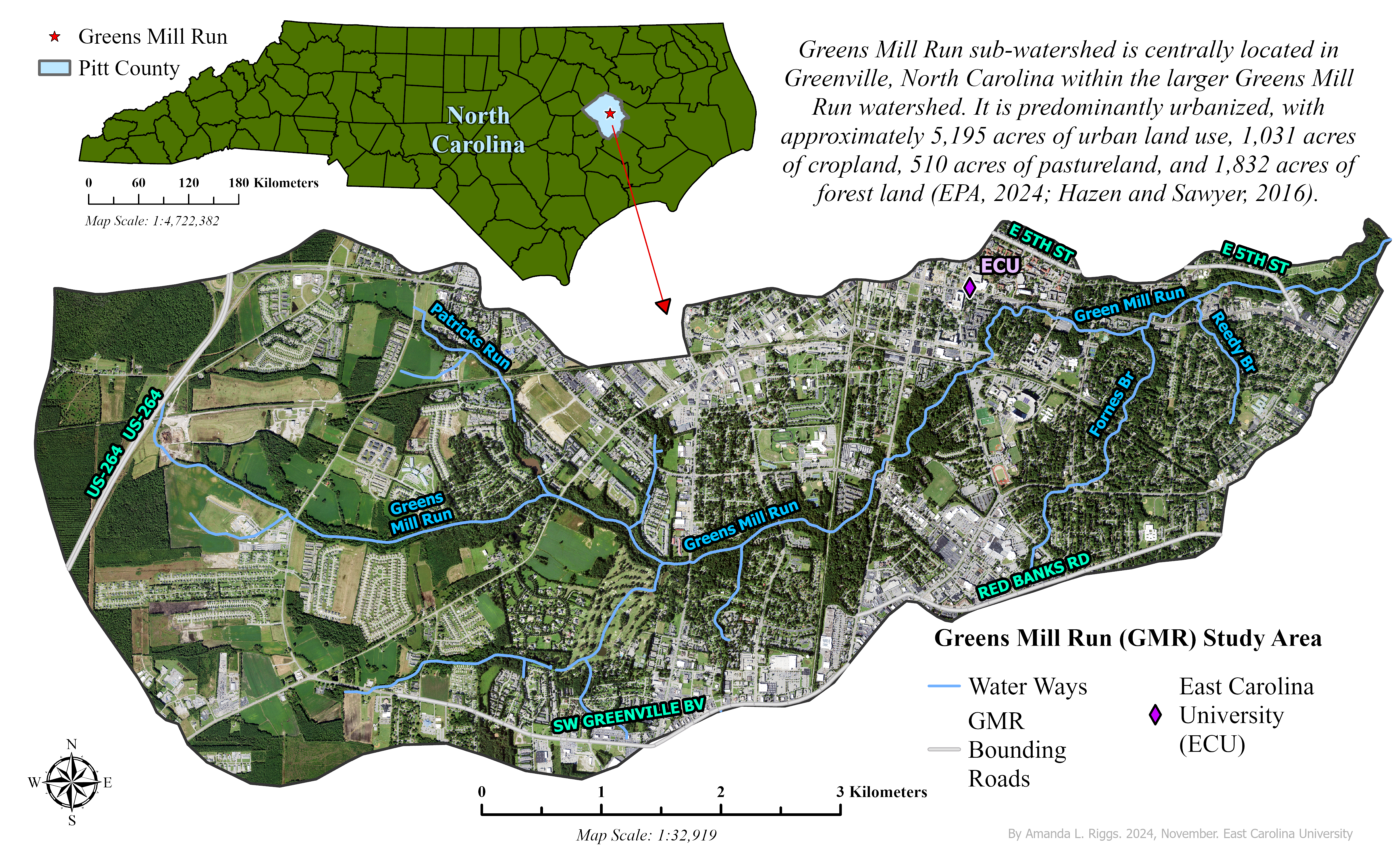
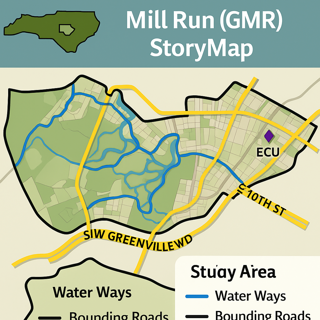
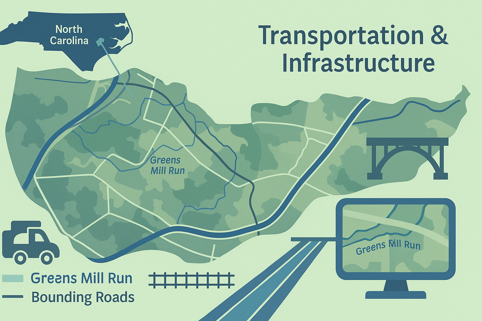
Map Gallery
Selected maps and layouts from recent GIS and remote sensing projects.

Workflows & Methods
Hydrology & DEM Conditioning Workflow
- Resample LiDAR-derived DEM and fill sinks.
- Generate flow direction and flow accumulation rasters.
- Create a stream raster using threshold-based accumulation.
- Burn streams into the DEM using conditional expressions.
- Recalculate flow direction/accumulation and extract stream network.
- Validate using reference data and overlap/intersection metrics.
Land Cover Classification & Change Detection
- Preprocess imagery (stack bands, clip to AOI).
- Create training samples and run supervised classification.
- Assess accuracy using a confusion matrix and validation points.
- Reclassify classes into unified categories for multi-year comparison.
- Compute change statistics and create change maps.
Automated Portfolio Layout Export (ArcPy)
- Scan a file geodatabase for key feature classes (streams, roads, AOIs).
- Build or update a map in ArcGIS Pro using those layers.
- Apply a standardized layout template and map frame extent.
- Export layouts to PNG/JPEG at web and print resolutions.